Redwood National and State Parks

Redwood National and State Parks

In 1918 paleontologists wanting to save the Coast Redwoods as a living link to our evolutionary past campaigned nationally to protect the trees. Three California redwoods state parks resulted: Prairie Creek (1923), Del Norte (1925), and Jedediah Smith (1929). To preserve the trees’ natural Coast Range setting and associated plants and animals, Redwood National Park was created in 1968 and expanded in 1978. The national park boundary encircled the three state parks to better protect superlative ancient redwood forests. In 1994 the National Park Service and California Department of Parks and Recreation began managing the parklands cooperatively, aiming to manage the parks the same.

Redwood National and State Parks holds 130,000 acres of forests, rivers, prairies, and rugged coastline, including 40,000 acres of old-growth redwood forests. Today, the Parks’ boundary extends from Crescent City, CA to just south of Orick, CA.

We visited Redwood National and State Parks in October 2024 while staying at the Rambling Redwoods RV Park in Crescent City, California at its northernmost end. We made a couple of visits to the park during our stay. The first visit was to Jedediah Smith State Park near Crescent City. During the second visit we drove most of the length of the park from north to south on the CA-101 with a detour along the Newton B. Drury Scenic Parkway.

Our visit to Jedediah Smith State Park started at the Hiouchi Visitor Center, a short drive from the RV park and just outside Crescent City. At the visitor center we were given printed directions to get to Howland Hill Road, a 10-mile narrow scenic drive which winds through the giant Redwoods and includes numerous pull-outs to allow vehicles to pass, and trailheads along the way, including the Boy Scout Tree Trail , Stout Grove, and Grove of the Titans Trail. Portions of Howland Hill Road were unpaved, but the road was readily passable by any passenger vehicle, although it was so winding and narrow that we rarely exceeded 15 mph along the road. The drive was spectacular, with giant redwoods literally inches from the road on each side, and shafts of light shining dramatically through the tree canopy.

We decided to take the Grove of the Titans Trail about half-way along Howland Hill Road. This trail was completed in summer 2022 to allow sustainable access to a group of ancient redwood trees named for their remarkable shape and size. The grove contains many tall and wide redwoods with complex features and fascinating adaptations. The trail was a 1.5-mile out and back trail with a small loop at the end. There were many awe-inspiring giant trees along this trail and some of the fallen trees were just as spectacular and interesting as the living ones. After our visit to the Grove of Titans, we completed the Howland Hill Road drive back to Crescent City.

For our second trip into the park, we drove the CA-101 most of the length of the park from north to south with a detour along the Newton B. Drury Scenic Parkway. The Scenic Parkway is a 10-mile section of two lane highway that bypasses a section of CA-101 through the heart of the old-growth redwood forest in Prairie Creek Redwoods State Park. North to south, features include numerous trailheads, Big Tree Wayside, Prairie Creek Visitor Center, and Elk Prairie Campground.

As we continued along the Scenic Parkway, we stopped at the Big Tree Wayside area. This is an easy walk to stunning old-growth redwood trees. A viewing platform and interpretive signage was located around the “Big Tree”, said to be one of the oldest in the park with a height estimated to be 286-feet and a diameter of 25-feet. We took a short circle trail next to the big tree that took us through even more spectacular Giant Redwood specimens.

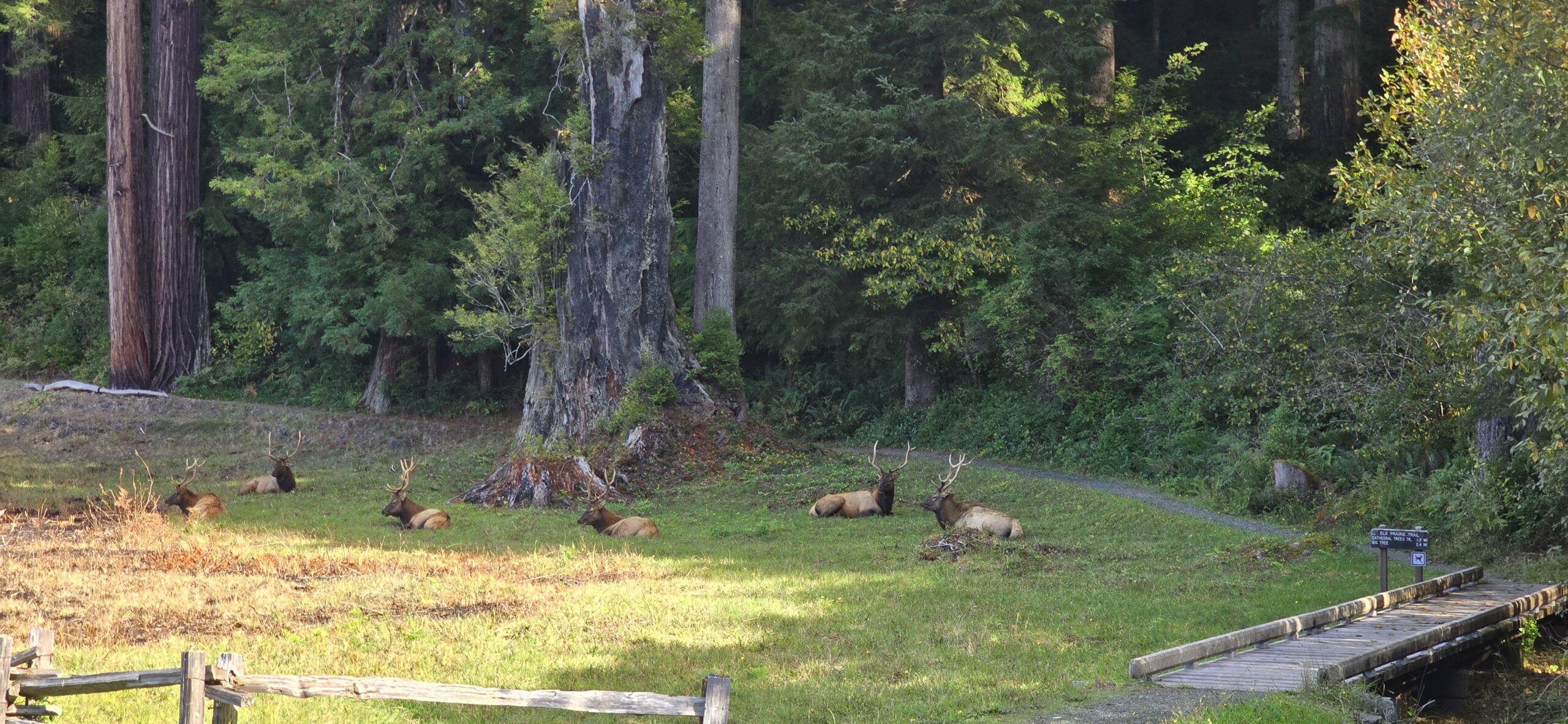
One of the highlights of this visit were the herds of Roosevelt Elk that live around the Elk Prairie area. We were able to watch the Elk as we picnicked at the Elk Meadow picnic area, and then again at the Elk Prairie area a short distance along the scenic parkway. These large Elk were quite majestic as they relaxed in the meadows.

We ended our trip at the Thomas H. Kuchel Visitor Center, located on the Pacific Coast. Exiting the back-door of the visitor center directly onto a sandy beach covered in driftwood, we were met with spectacular views up and down the coast, accompanied by the white breakers reflecting the low afternoon sun.

We really enjoyed our time in the Redwoods. There was a real sense of timelessness amongst trees that have been here for up to 2000 years, and gratitude for the work that has been put-in by the Park Services and others to protect the ancient forests and surrounding areas.

Photos of our visit are provided below. Click on the thumbnails to view the photos.

Truck Upgrades – Mudflaps and Tonneau Cover

Truck Upgrades – Mudflaps and Tonneau Cover

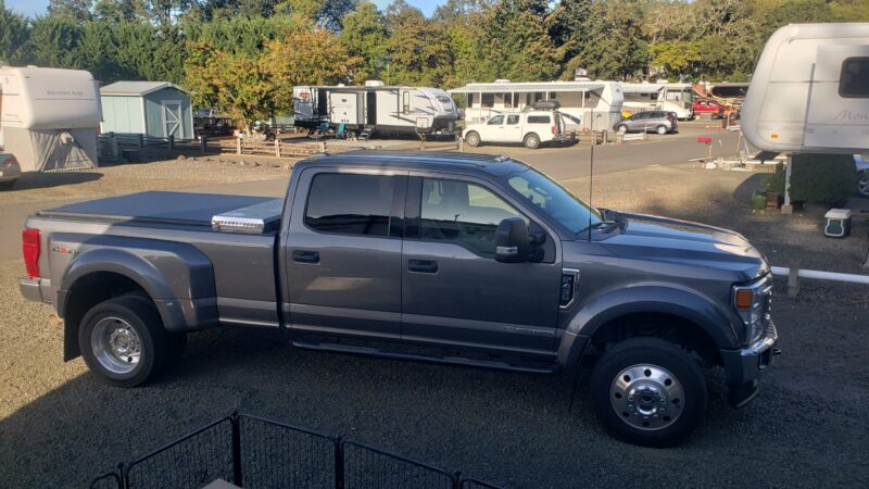
While stationary for a month in the Pacific Northwest, we took the opportunity to do some upgrades to our 2022 Ford F-450 truck that we’ve had on the wish-list for a while.

Mudflaps

When we bought the one-year-old truck in 2022 it came with Ford OEM mudflaps on the front only. After about a year, one side had completely torn and broken-off, and the other side was partially torn. The main reason for getting new mudflaps, however, was to avoid the splatter that was thrown-up by the trucks rear wheels and would accumulate on the front of the 5th wheel.

After researching mudflaps quite a bit, and considering both Ford OEM and other options, we settled on the Duraflap brand mudflaps. These mudflaps had great reviews in several forums and were easy to order and customize on the Duraflap website. They weren’t available to purchase in stores, but the online order process and shipping was super-easy and efficient.

When ordering on their website, you select your make, model, and year of truck and then you have several options to select from related to mudflap dimensions and metal weights. The website includes information and guidance on how to measure the truck height to select the best mudflap dimensions. Based on the website guidance we selected the standard length and standard width mudflaps. These give about 7-inch clearance at the rear tires to the road, which drops to about 5-inches when towing the 5th wheel. The short and long options reduce or increase the standard length by 2-inches respectively.

The other main option when ordering is the addition of stainless-steel weights to the bottom of the flaps. There are many options for finish and pattern on their website, however we opted to go with plain mudflaps (no weights) as we liked the clean look of all black flaps with our grey truck. We had read several reviews that said the weights were not needed as the mudflaps themselves were quite thick and rigid.

Installing the mudflaps was a relatively simple process, the most complicated part being the array of metric and imperial sockets and wrenches that were needed to remove and install the various existing and new fasteners. One of the benefits of the Duraflap mudflaps is they are “no-drill”, using existing holes and a combination of new and re-used fasteners.

Based on the limited use to-date, the Duraflap mudflaps get a thumbs-up from us. Initial performance seems good, although we haven’t yet towed the 5th wheel since installing them, so that will be the best test. I’ll update the post once we’ve done some towing.

Tonneau Cover

We wanted to install a tonneau cover to provide additional security and weather protection for items in the truck bed when we are not towing the fifth wheel, and to provide a cleaner appearance for the truck. Some tonneau manufacturers claim up to a 10-percent improvement in fuel economy, so we’ll have to see if that proves to be true.

Our choice of tonneau covers turned out to be limited as we needed a cover that could be folded and left on the truck when towing the 5th wheel, and also work with our truck-mounted toolbox. After researching several manufacturer’s offerings on-line, as well as YouTube reviews on some of our favorite RVing channels, we decided the ACCESS® TOOLBOX EDITION Roll-Up Cover by Agri-Cover, Inc. would best meet our needs. This is an affordable American made product that has excellent reviews. The on-line ordering process was straight forward on their website and shipping was quick and efficient.

Installing the tonneau cover proved to be straight-forward. All the necessary parts and mounting hardware was included, even some alcohol wipes to clean the surfaces where the adhesive gaskets were installed.

Although the tonneau cover install was easy, we also needed to make some adjustments and modifications to the latching mechanism on our low-profile toolbox to make it work with the tonneau. Because it’s a low-profile design, the existing latches on the toolbox were so low that they were blocked by the tonneau cover header bar. We were able to solve this by installing new exterior latches that we purchased on Amazon on the sides of the toolbox and disabling the original toolbox latches by removing the latch striker.

We are very happy with the initial install of the tonneau cover. I’ll update this post once we have some experience using it stowed while towing, and also to find out if we do get better fuel mileage when its deployed.

White Sands National Park

White Sands National Park

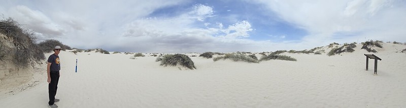
Rising from the heart of the Tularosa Basin is one of the world’s great natural wonders – the glistening white sands of New Mexico. Great wave-like dunes of gypsum sand have engulfed 275 square miles of desert, creating the world’s largest gypsum dune field. White Sands National Park preserves a major portion of this unique dune field, along with the plants and animals that live here.

We visited the White Sands National Park in early April 2024 while staying at the Hacienda RV Resort in Las Cruces, New Mexico about a one-hour drive away.

We stopped at the visitor center at the park entrance and learned about the unique gypsum dunes. Approximately 12,000 years ago, the land within the Tularosa Basin featured large lakes, streams, grasslands, and Ice Age mammals. As the climate warmed, rain and snowmelt dissolved gypsum from the surrounding mountains and carried it into the basin. Further warming and drying caused the lakes to evaporate and form selenite crystals. Strong winds then broke up crystals and transported them eastward. A similar process continues to produce gypsum sand today.

From the visitor center we took the Dunes Drive, an eight-mile out-and-back scenic drive that leads from the visitor center into the heart of the gypsum dune field. Along the road, there were outdoor exhibits, hiking trails, and picnic areas. Our first stop was the Dune Life Nature Trail. This was an easy one mile loop trail that was a great way to experience the dune field, and its typical landscape of sparse shrubs, cacti, and trees. There were informational signs along the loop.

We also visited the Interdune Boardwalk, an elevated boardwalk that leads you through the fragile interdune area to a scenic view of the dune field and the Sacramento mountains. There were extensive information displays along the boardwalk with information on the geology, plants, and animal life of the area.

We tried our hand at sand sledding, one of the most unique things to do in White Sands National Park. We met with little success and came to the conclusion that if you weigh more than the average 12-year-old, the physics of sand sledding are not in your favor!

Visiting Great Sand Dunes National Park was a unique experience. Some areas of the park had very little plant life and the bright white gypsum dunes looked just like snow drifts. Interestingly, the dunes always stay fairly cool even on bright sunny days due to the high water table and reflective sand.

Photos of our visit are provided below. Click on the thumbnails to view the photos.


Saguaro National Park – Tucson, AZ

Saguaro National Park – Tucson, AZ

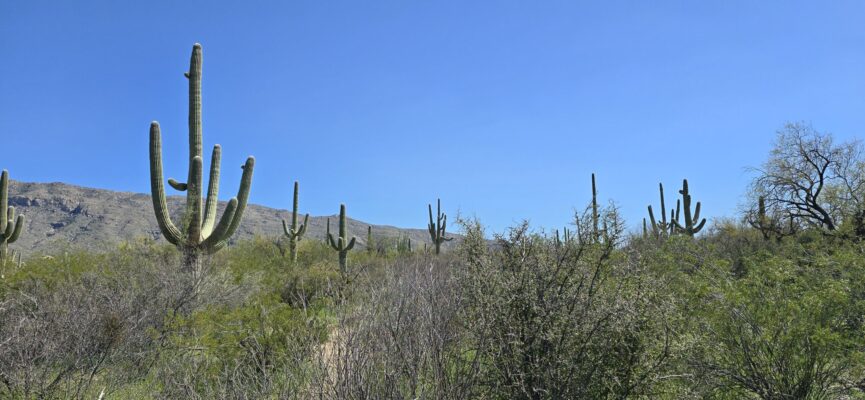
Photograph of a giant saguaro cactusThe saguaro (suh-waa-row), also known as the giant cactus, has been an iconic symbol of the American southwest for ages. These majestic beings are easily recognized by their size and structure, sometimes reaching a height of 50 feet tall. They are native to the Sonoran Desert and do not grow naturally elsewhere.

We visited Saguaro National Park in late March 2024 while staying at the Tombstone Territories RV Resort in Huachuca City, Arizona, about a one-hour drive from the park. The Saguaro National Park has two districts – Rincon Mountain District and Tucson Mountain District – that are separated by the City of Tucson. We visited the Rincon Mountain District on the east side of Tucson, as that was closest to us.

We started our visit at the Rincon Mountain Visitor Center where we were fascinated to learn how long it takes a Saguaro cactus to grow. Branches normally begin to appear when a saguaro reaches 60 to 75 years of age. When a saguaro reaches 35 years of age, it begins to produce flowers. An adult saguaro is generally considered to be about 125 years of age. It may weigh 2 or more tons and be as tall as 50 feet. The average life span of a saguaro is probably 150 – 175 years of age. However, biologists believe that some plants may live over 200 years.

From the visitor center we drove the Cactus Forest Scenic Loop Drive which is a winding paved road that features several trailheads, scenic vistas and pullouts in a total of 8 miles.wide view of numerous ocotillo cactiWe stopped at the Mica View picnic area to enjoy our lunch in the middle of the Sonoran Desert. From the picnic area continued down the scenic drive to the Desert Ecology Trail, a 1/4-mile paved trail with information exhibits along the way about the plants and animals that comprise the Sonoran Desert ecosystem. While the saguaro cactus is the undoubted star of the park, there are a large variety of other plants in the Sonoran Desert. We particularly enjoyed seeing the Teddy Bear Cholla (not nearly as cuddly as its name!), and the elegant ocotillo.

At the southern tip of the scenic loop road, we reached the 1-mile-long Freeman Homestead trail and followed it to the site of an old homestead foundation. There wasn’t much evidence left of the homestead, but the trail was enjoyable and took us through a grove of large saguaros and a desert wash.

Photos of our visit are provided below. Click on the thumbnails to view the photos.

Petrified Forest National Park – Petrified Forest, AZ

Petrified Forest National Park – Petrified Forest, AZ

We made two half-day trips to the Petrified Forest National Park in early November 2023 while staying at the Holbrook/Petrified Forest KOA Journey RV Park, about a half-hour drive from both the south and north park entrances. The Petrified Forest National Park stretches north and south between Interstate 40 and Highway 180. There are two entrances into the park, each one with a visitor center. The petrified log fields are found at the southern end of the park. Outlooks, trails, cultural sites, and painted desert badlands are found in the middle and northern sections.

During both of our visits we drove the full length of the park, southbound on the first trip, and northbound the second time. We stopped at some different overlooks and points of interest each day.

The Painted Desert has a very unique, other-worldly, landscape with colored bands running horizontally through its rolling hills. The colorful Painted Desert badlands are composed of bentonite, a product of altered volcanic ash. The clay minerals in the bentonite can absorb water and swell much as eight times their dry volume. The expansion and contraction properties of the bentonite cause rapid erosion including by preventing much vegetation from growing on—and thus fixing—the slopes of the hills.

There were also views of spectacular mesas and buttes along the park road. Their flat tops are created by the presence of cap rocks, more erosion-resistant rock such as sandstone over softer clays. The softer rock is protected by the cap stones, but, as the sides weather and the protective rock falls down, the softer rock erodes away as it is exposed to the elements. Without the capstone, the feature becomes another rolling badland. Mesas typically are wider than they are tall while buttes are taller than they are wide. Towers, monuments, and hoodoos are even further eroded features.

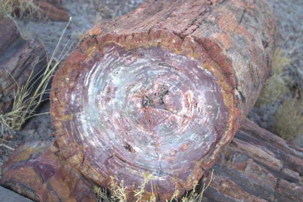
The petrified trees that lie strewn throughout the southern sections of the park are an amazing sight. Initially, looking out over the fields of petrified logs, you might think you are looking at the remnants of recently felled trees, but then you realize that these are actually fossilized trees that are some 200 million years old, and there is a sense that time has stood still in these areas. The quartz within the petrified wood is hard and brittle, fracturing easily when subjected to stress. It is thought that during the gradual uplifting of the Colorado Plateau, starting 60 million years ago, the still buried petrified trees were under so much stress they broke like glass rods. The crystal nature of the quartz created clean fractures, evenly spaced along the tree trunk, giving the appearance today of logs cut with a chainsaw.

Towards the north end of the park, we visited the cultural site of the Puerco Pueblo. A 0.3-mile paved walk winds through the remains of a hundred room pueblo, occupied by the ancestral Puebloan people over 600 years ago. We were able to see Petroglyphs along the south end of the trail, that are still clear and well defined hundreds of years after they were created.

Probably our favorite spot in the park was the Blue Mesa trail, a 1-mile loop descending from the mesa through the hills of the Painted Desert badlands. The loop trail offers the unique experience of hiking among badland hills of bluish bentonite clay as well as petrified wood. We wandered among the hills and petrified logs and were again struck by the timeless quality of the area.

We were able to take the dogs with us on the Giant Logs trail, a 0.4-mile loop behind Rainbow Forest Museum towards the south end of the park. The trail winds around some of the largest and most colorful logs in the park. “Old Faithful”, at the top of the trail, is almost ten feet wide at the base!

Photos of our visit are provided below. Click on the thumbnails to view the photos.

×